Topological Europe Map
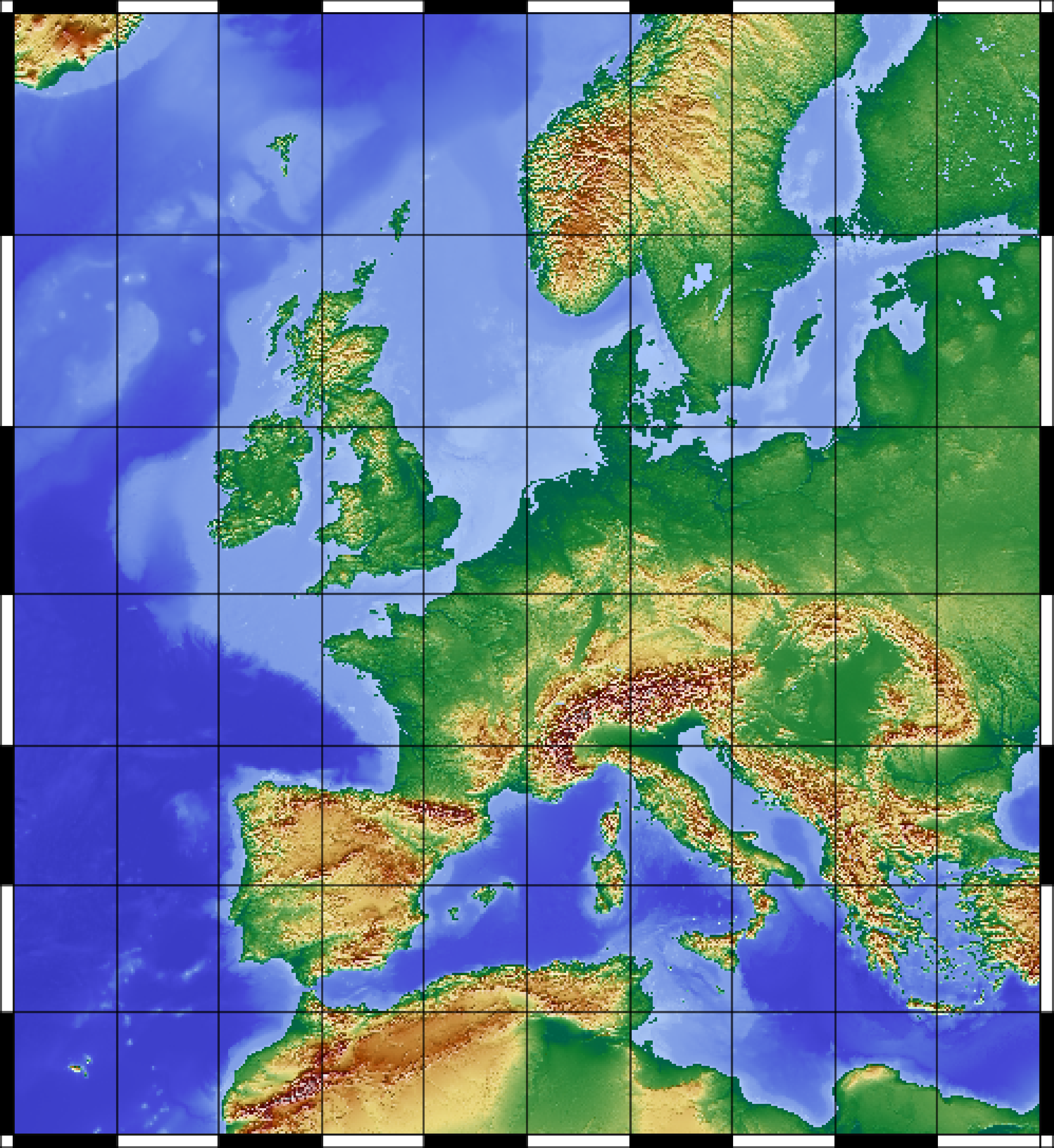
Shell Script
	#!/bin/sh

	#GMT
	gmt=$(which GMT)

	#Definition
	output=europe
	range="-R-20/40/30/70"
	proj="-JM6i"
	scale="-Lf-10/69/70/500"

	#Cut Topological Data
	$gmt grdcut ETOPO1_Ice_g_gmt4.grd
	$range -G$output.grd

	#Create Continent Shadows
	$gmt grdgradient $output.grd -A180
	-Nto.3 -G${output}_shadows.grd

	#Create Ocean and Land Maps
	$gmt grdimage $output.grd -Cocean.cpt
	$range $proj -P -K > $output.ps

	$gmt pscoast -Gc -Di -R -J -K -O >>
	$output.ps

	$gmt grdimage -Cland.cpt -R -J -K -O
	$output.grd -I${output}_shadows.grd
	>> $output.ps

	$gmt pscoast -Q -K -O >> $output.ps

	#Plot
	$gmt psbasemap -B10g5 -R -J -O $scale
	>> $output.ps
land.cpt
	0 0 97 71		50 16 122 47
	50 16 122 47  		500 232 215 125
	500 232 215 125    	1500 161 67 0
	1500 161 67 0    	2000 130 30 30
	2000 130 30 30   	3000 110 110 110
	3000 110 110 110   	4000 255 255 255
	4000 255 255 255  	6000 255 255 255

	B 0 97 71
	F 255 255 255
	N 255 255 255
ocean.cpt
	-11000 36 38 175        -5500 56 58 195
	-5500 56 58 195         -3000 70 72 214
	-3000 70 72 214         -2000 81 102 217
	-2000 81 102 217        -750 100 129 223
	-750 100 129 223        -70 131 161 230
	-70 131 161 230         -20 164 192 240
	-20 164 192 240          0 170 200 255

	 N 170 200 255
	 F 170 200 255
	 B 170 200 255